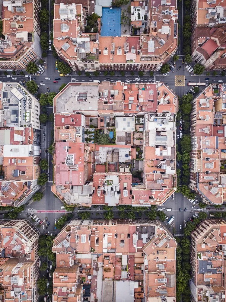
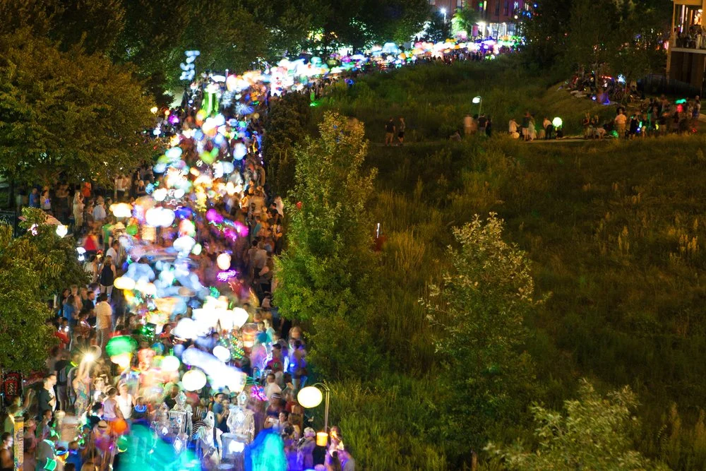
Placemaking is one of those ideas that sounds obvious once you hear it: design public spaces around the people who actually use them, not around cars, traffic flows, or real estate maximums. Simple concept, harder to execute, and when done right, the economic and social returns are measurable. The High Line in New York City, a decommissioned freight railway, drew $2 billion in surrounding property value increases within a decade of opening. San Antonio’s River Walk generates $3 billion in annual economic activity. Bryant Park’s 1992 revitalization pushed adjacent office rents up 40%. The physical transformation is just the beginning.
This post covers what placemaking actually is, who makes it happen, how to start an initiative, and 15 real examples worth studying. We also look at where technology fits in, including how digital passport experiences are being used to activate the places placemaking creates.
What is placemaking?
Placemaking is the practice of designing, activating, and managing public spaces around human behavior and community need rather than infrastructure and automobiles. The term was shaped largely by the Project for Public Spaces, which built on urbanist William H. Whyte’s observation in the 1970s that the most successful public spaces are those people actually choose to be in, not just pass through.
A placemaking project might be physical: converting a highway overpass into a park, closing a street to cars, or restoring a historic market. It might be programmatic: recurring farmers markets, outdoor concerts, or pop-up installations that give people a reason to show up. It might be digital: wayfinding tools, gamified trail experiences, or event calendars that connect residents to what’s happening in their neighborhood. Often it’s all three.
What distinguishes placemaking from standard urban planning is the emphasis on community engagement from the start. Residents, local businesses, government, and private partners all have a stake, and the best projects surface that early before a shovel goes in the ground.
What are the benefits of placemaking?
The clearest benefits are economic and social, and they tend to compound.
Economically: well-designed public spaces draw foot traffic, which benefits adjacent businesses, raises property values, and creates new tax revenue. Granville Island in Vancouver, once an industrial area, now generates over $215 million in annual economic activity. Klyde Warren Park in Dallas, built over a sunken freeway, catalyzed a surge of restaurant and retail development in the surrounding Uptown neighborhood.
Socially: public spaces give communities a shared identity. They’re where neighbors meet, where culture gets expressed, and where belonging gets built. The Project for Public Spaces has documented consistently that walkable, human-scale spaces correlate with higher civic participation and stronger neighborhood attachment. Copenhagen’s Harbor Baths, which converted an industrial waterfront into a public swimming area, became a neighborhood anchor that residents actually use every season.
Environmentally, placemaking that prioritizes walkability and transit reduces car dependency. Barcelona’s Superblocks program, launched in 2016, rerouted vehicle traffic from interior city blocks and returned that space to pedestrians, cutting local pollution and noise in the process. Placemaking also feeds directly into sustainable destination marketing — a well-designed walkable district is the most convincing thing a DMO can put in front of a visitor.
Who is responsible for placemaking?
No single entity owns it. Successful placemaking is almost always a coalition.
Local government sets the policy context, controls public land, and secures or allocates funding. Without municipal buy-in, even well-funded private initiatives face permitting and long-term maintenance challenges.
Community members provide the local knowledge no outside planner has. What works in one neighborhood fails in another. Effective placemaking processes run community workshops, surveys, and listening sessions before committing to a design direction.
Private sector partners including developers, local businesses, and foundations often co-fund projects and take on programming. Bryant Park’s remarkable turnaround was driven partly by the Bryant Park Corporation, a business improvement district, not just the city.
Destination marketing organizations are increasingly active here. DMOs and CVBs recognize that placemaking creates the visitor experiences their marketing promises. A destination that invests in a great public market, a riverfront trail, or a neighborhood food hall gives its marketing team something concrete to sell and gives visitors a reason to extend their stay. Placemaking is, in many ways, the physical layer underneath the experience economy.
How to start a placemaking initiative
The Project for Public Spaces recommends a “lighter, quicker, cheaper” approach: test ideas at low cost before committing to capital investment. Here’s how most successful initiatives move:
- Talk to the community before designing anything. Hold listening sessions, walk the space with residents, and run surveys to understand how people actually use or avoid the area.
- Define the vision collaboratively. What should this space feel, sound, and function like? Who is it for? What would make someone come back next week?
- Run a low-cost activation first. A temporary farmers market, pop-up seating, or weekend programming can test an idea for a few hundred dollars before you spend millions.
- Identify key locations: underused parks, empty lots, decommissioned infrastructure, surface parking lots. The best placemaking projects often start where the need is most obvious.
- Secure partners. Map who else has a stake: business improvement districts, nonprofits, anchor employers, schools. Each partner brings funding, programming, or political capital.
- Develop a phased plan. Sequence the quick wins first to build momentum, then layer in permanent improvements over time.
- Build in maintenance and activation from day one. A park without programming empties out. The best public spaces have year-round calendars.
15 examples of placemaking success stories
1. Times Square, New York City (2009)
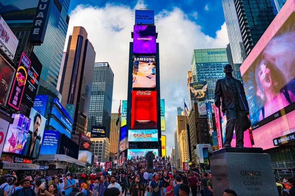
The New York City Department of Transportation closed Broadway to vehicles through Times Square starting in 2009, converting the space to pedestrian plazas. The NYC DOT’s own study found a 25% increase in retail sales in the corridor after the change. Today it’s one of the most visited public spaces in the world, pedestrian counts and retail performance both up sharply from the pre-transformation baseline.
2. Pike Place Market, Seattle (1971)
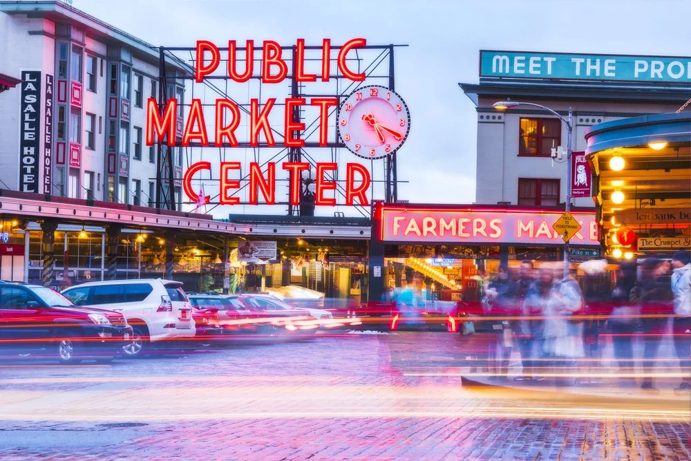
Seattle voters approved preserving Pike Place Market in 1971 against pressure to demolish it for urban renewal. The community-driven decision to restore rather than replace created one of the most-studied examples of historic placemaking in the US. Pike Place now draws over 10 million visitors annually, anchoring Seattle’s waterfront economy while still functioning as a working public market for local farmers and craftspeople.
3. The High Line, New York City (2009)

A decommissioned freight railway on Manhattan’s west side, the High Line opened as an elevated public park in 2009 after Friends of the High Line spent years advocating for its preservation. The High Line’s economic impact documentation showed over $2 billion in surrounding property value appreciation and catalyzed billions more in adjacent real estate development in what became the Hudson Yards neighborhood.
4. Granville Island, Vancouver (1970s)

Canada Mortgage and Housing Corporation’s 1970s conversion of a deteriorating industrial peninsula into a mixed-use public market, arts district, and community space is one of the most-cited placemaking transformations in North America. Granville Island generates over $215 million in annual economic activity, supporting hundreds of local businesses and cultural tenants.
5. Copenhagen Harbor Baths (2002)

Copenhagen cleaned its harbor water enough to swim in by 2002 and opened public baths directly in the city center. Designed by BIG (Bjarke Ingels Group) and PLOT, the baths became a neighborhood institution immediately, used year-round by locals and well-documented as a driver of residential desirability in the surrounding Islands Brygge neighborhood.
6. Bryant Park, New York City (1992)
By the late 1980s Bryant Park was known primarily as a drug market. The Bryant Park Corporation, a business improvement district formed specifically to manage the space, led a redesign that opened sightlines, added seating, and built a year-round programming calendar. Adjacent office rents rose 40% in the decade following the renovation, per William H. Whyte’s Project for Public Spaces documentation of the transformation.
7. San Antonio River Walk, Texas (1968)

The River Walk’s origins date to the 1930s when architect Robert Hugman proposed converting a flood-prone waterway into a pedestrian promenade. Commercial development came slowly; the 1968 World’s Fair accelerated it dramatically. The San Antonio River Walk generates $3 billion in annual economic activity, per the San Antonio Convention and Visitors Bureau, functioning as the connective tissue between downtown hotels, restaurants, and convention activity.
8. Barcelona’s Superblocks, Spain (2016)

Barcelona’s city government began consolidating vehicle traffic onto major arteries in 2016, freeing interior blocks from through traffic. The freed space went back to pedestrians: seating, plantings, playground equipment, and cultural programming. Research published in Environment International estimated that full Superblock implementation across the city could prevent 667 premature deaths annually from air quality improvements alone.
9. The BeltLine, Atlanta (2005)
Ryan Gravel’s 1999 Georgia Tech thesis proposed converting a 22-mile abandoned railway loop around Atlanta into a transit, trail, and greenspace corridor. Atlanta BeltLine Inc. has been building it out since 2005. The project has catalyzed over $10 billion in private real estate investment in adjacent neighborhoods, per Atlanta BeltLine Inc.’s own economic impact reporting, while creating a connected network of parks and trails that spans dozens of formerly disconnected neighborhoods.
10. Millennium Park, Chicago (2004)
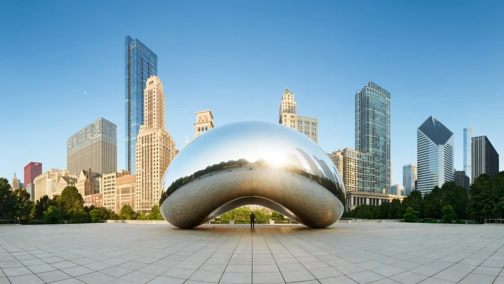
Chicago converted a former rail yard and parking lot into Millennium Park, which opened in 2004 anchored by Anish Kapoor’s Cloud Gate sculpture and Jaume Plensa’s Crown Fountain. The Chicago Loop Alliance estimated the park draws over 25 million visitors annually, making it one of the most-visited urban parks in the US, and surrounding property values rose roughly 80% in the five years post-opening.
11. The Distillery District, Toronto (2003)

Cityscape Development Corporation’s adaptive reuse of the former Gooderham and Worts distillery complex, the largest collection of Victorian industrial architecture in North America, preserved the buildings and converted them into galleries, studios, restaurants, and event venues. The pedestrian-only Distillery District opened in 2003 and became one of Toronto’s most-visited neighborhoods within a decade.
12. Klyde Warren Park, Dallas (2012)

The Woodall Rodgers Deck Park Foundation built Klyde Warren Park over a sunken freeway that had severed Uptown Dallas from the Arts District for decades. The park opened in 2012, funded by a mix of city bonds, federal grants, and private philanthropy. The Urban Land Institute directly credited the park with stimulating over $1.5 billion in adjacent real estate development.
13. Providence River Pedestrian Bridge, Rhode Island (2019)

Providence converted a former highway bridge over the Providence River into a public pedestrian crossing connecting downtown to the Jewelry District. The project, completed in 2019, was part of a broader riverwalk initiative and has become a key connector between neighborhoods that previously required a significant detour on foot.
14. Parklets, San Francisco (2010)
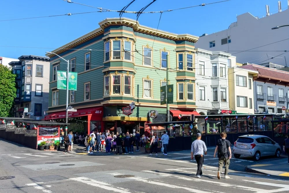
San Francisco’s Pavement to Parks program, launched in 2010, gave businesses the ability to convert curbside parking spaces into small public seating and planting areas. Dozens of parklets appeared across neighborhoods including the Mission, the Castro, and Hayes Valley. The program became a national model; cities from New York to Portland adopted similar frameworks in the following decade.
15. The Underline, Miami (2016)
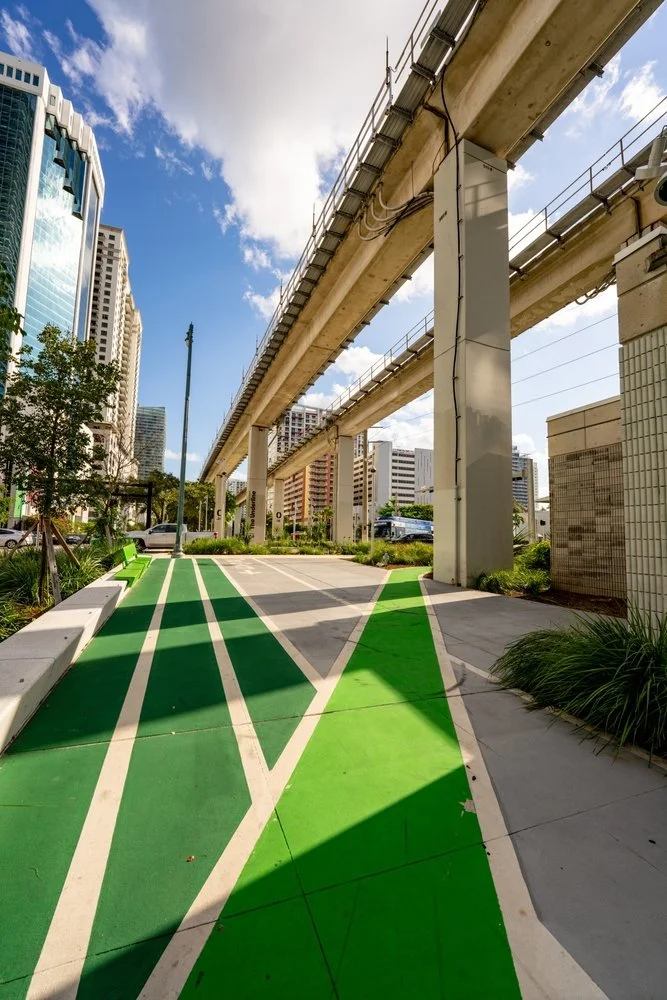
Friends of The Underline is building a 10-mile linear park beneath Miami’s Metrorail corridor, converting what had been underlit, underused right-of-way into a connected trail and park system linking 10 Miami neighborhoods. The first phase opened in 2021. The project is modeled on the High Line and BeltLine and is designed to connect neighborhoods that currently have no safe pedestrian or cycling route between them.
What these 15 projects share isn’t a design style or a budget size. It’s a decision to treat public space as infrastructure for people rather than for vehicles or real estate yield. The ones that worked fastest shared three things: early community involvement that shaped the design rather than rubber-stamping it, a programming strategy that gave people a reason to return on a regular schedule, and at least one private or civic partner willing to take on long-term stewardship. The ones that struggled longest had strong physical designs but no one responsible for keeping them alive after the ribbon-cutting.
Cost-effective placemaking ideas
Not every placemaking project starts with a $50 million deck over a freeway. Most begin smaller, and some of the most durable transformations started with almost nothing. Here are 13 approaches that consistently work at low cost:
- Recycled and upcycled materials: Pallets, tires, and reclaimed lumber can furnish a temporary public space for a few hundred dollars, and the handmade aesthetic often reads better than manufactured street furniture.
- Community-led events: Block parties, neighborhood clean-ups, and street fairs activate existing spaces without infrastructure investment. They also surface community relationships you need before the capital projects start. Our guide to community engagement strategies covers how to structure this kind of outreach effectively.
- Farmers markets: A weekly farmers market gives residents a reason to return to a space on a schedule. It also generates modest revenue for local vendors and tests whether a space has the foot traffic to support more permanent activation.
- Murals: A local artist commission on a blank wall costs a few thousand dollars and changes how people relate to a block. Wicker Park in Chicago, the Arts District in Los Angeles, and Wynwood in Miami all built early identity through mural programs before the galleries and restaurants followed.
- Temporary installations: Chalk art, light projections, and temporary seating test spatial concepts before committing to permanent design. The Project for Public Spaces calls this “place prototyping.”
- Pop-up shops and food stalls: A rotating cast of vendors makes a space feel alive and gives entrepreneurs low-risk access to foot traffic. Many permanent small businesses in revitalized neighborhoods started as pop-ups.
- Community gardens: Urban farming projects convert vacant lots into productive green space and give neighbors a shared maintenance task that builds relationships over time.
- Interactive event activations: Musical instruments, interactive art, and playground equipment in unexpected places encourage lingering and social interaction. Copenhagen has outdoor pianos at transit stops. New York has free ping-pong tables in parks.
- Street performance: Permitted busking and theater programs animate public space without physical changes. Buenos Aires, New Orleans, and New York all actively cultivate street performance as part of their public space strategies.
- Wayfinding and signage: Good wayfinding helps visitors discover what a neighborhood already has. It’s often the cheapest intervention with the highest return for tourism-adjacent destinations.
- Water features: Splash pads and small fountains are disproportionately effective at drawing families and creating a consistent reason to gather. Crown Fountain in Millennium Park is an extreme version of this; a splash pad in a neighborhood park works on the same principle.
- Bicycle-friendly infrastructure: Bike racks, repair stations, and protected lanes encourage cycling, which puts more pedestrians in public space and reduces parking pressure on streets.
- Digital passport experiences: One of the more recent tools in the placemaking toolkit is the gamified trail: a digital experience that sends participants to specific locations in a neighborhood to check in, complete challenges, and earn badges. CTVets250 used Seeker XP to build the Connecticut Revolutionary War Trail: a digital passport across 15 historic sites in Connecticut that turns a road trip into a structured discovery experience. Participants check in at each site, earn badges, and unlock rewards, and the organizers end up with first-party data on which sites drove the most engagement. The same mechanic works for restaurant weeks, art trails, shop-local programs, and heritage districts.
Placemaking FAQ
What is an example of successful placemaking?
The High Line in New York City is one of the most cited examples of successful placemaking. Friends of the High Line spent years converting a decommissioned elevated freight railway into a public park, which opened in 2009. It drew over $2 billion in surrounding property value appreciation and catalyzed the development of an entirely new neighborhood. Bryant Park, also in New York, is another well-documented case: a redesign led by the Bryant Park Corporation in 1992 transformed what had been a drug market into one of Midtown Manhattan’s most-used public spaces, raising adjacent office rents by 40%.
What is the difference between placemaking and urban planning?
Urban planning is the broader discipline that governs land use, zoning, infrastructure, and long-range development policy across a city or region. Placemaking is a more specific practice focused on individual public spaces: how they’re designed, programmed, and managed to encourage actual human use. Urban planning sets the conditions; placemaking works at the street-level scale of a park, a market, a waterfront, or a pedestrian corridor. The two overlap, but a placemaking project can happen without a formal planning process, while urban planning often proceeds without any meaningful placemaking at all.
How is placemaking funded?
Most placemaking projects are funded through a mix of sources rather than any single one. Public funding — city capital budgets, federal grants through programs like the Transportation Alternatives Program, and state economic development funds — covers major infrastructure. Private philanthropy and business improvement districts often fund programming, maintenance, and smaller-scale improvements. In some cases, developers contribute to public space as part of a negotiated community benefit. The Bryant Park Corporation is a particularly well-studied example of a self-sustaining funding model, where revenue from park events and concessions covers most operating costs.
What makes a placemaking project fail?
The most common failure mode is a strong physical design with no programming or stewardship plan behind it. A park that looks good in renderings empties out without a reason for people to return. The second failure mode is skipping meaningful community input: projects designed without genuine resident involvement often miss how people actually use a space and create environments that feel foreign to the neighborhood. A third is treating placemaking as a one-time capital project rather than an ongoing operation. The Project for Public Spaces has documented this pattern across dozens of failed public spaces: the design gets built, the ribbon gets cut, and nothing happens to maintain the life of the place after that.
How does digital technology fit into placemaking?
Technology plays a growing role in both activating places and measuring whether they’re working. On the activation side, tools like digital passports and gamified trail experiences give visitors a structured reason to move through a destination’s public spaces: checking in at locations, earning badges, and unlocking rewards. On the measurement side, organizations can track which locations drove the most participation, which times of day see the heaviest use, and which parts of a trail or district are underperforming. That’s data that physical design alone doesn’t generate. For DMOs and CVBs, technology also bridges the gap between a great public space and a visitor who knows it exists: a well-structured digital engagement program can drive discovery and repeat visits in a way that a sign or a brochure can’t.
The Discover Grange Home Tour shows what this looks like outside traditional destination marketing. Johnson Development used Seeker XP to turn a nine-builder model home park in Katy, Texas into a digital passport where prospective buyers collected badges room by room and earned entries into a $2,500 prize draw, turning a sales circuit into something people actually wanted to finish.
How technology supports placemaking
Physical design creates the space. Programming fills it. Technology increasingly does both jobs, connecting people to places they might not have found and giving organizations the data to understand whether a place is actually working.
For destination marketers specifically, the gap between a great public space and a visitor who knows about it and has a reason to go there is real. A restored riverfront or a revitalized historic district needs discovery infrastructure: a trail experience, an events calendar, a guide that tells the visitor where to go and what to do when they get there.
Seeker XP’s check-in challenges and digital passport mechanics let DMOs build structured trail experiences across a destination’s public spaces. Participants check in at designated locations, earn digital badges, and compete on a leaderboard. The DMO gets a dataset showing which spaces drove the most participation. That’s placemaking measurement that physical design alone can’t provide.
Hudson County put this into practice with HC Urban Adventures, mapping 31 historic landmarks and neighborhood diners across twelve municipalities into one GPS check-in passport that gives a revitalized waterfront a reason for people to actually show up.
If you’re a destination marketer working on a placemaking initiative and want to see what a digital trail experience could look like on top of it, book a demo here.